MapTools

168 tools · 20 categories · updated Oct 26, 2026

Every map tool,
one directory.

Map makers, GIS, basemaps, APIs, imagery and location data — with pricing, licensing rules and alternatives for each.

Try
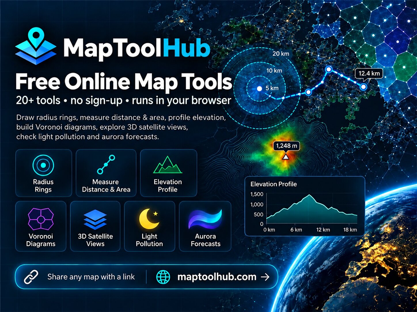
Sponsored Maptoolhub — free online map tools — Draw radius rings, measure distance and area, profile elevation, build Voronoi diagrams, explore 3D satellite views, check light pollution and aurora forecasts.

Online Map Makers 12

All Map Makers

Google My Maps

google.com

Free custom maps with pins, lines and layers on Google Maps

FreeMap Makers12

Felt

felt.com

Collaborative web maps for teams, from sketches to GIS data

FreemiumMap Makers9

uMap

umap.openstreetmap.fr

Open-source map maker on OpenStreetMap

Open sourceMap Makers9

MapChart

mapchart.net

Color countries, states and regions to make simple choropleth maps

FreemiumMap Makers7

Mapline

mapline.com

Map business data, territories and routes from Excel

FreemiumMap Makers7

StoryMapJS

storymap.knightlab.com

Free tool to tell stories along a sequence of map locations

FreeMap Makers6

ArcGIS StoryMaps

storymaps.arcgis.com

Story maps that combine maps, text and media

FreemiumMap Makers5

BatchGeo

batchgeo.com

Paste a spreadsheet, get a map of your locations

FreemiumMap Makers5

Maptive

maptive.com

Business mapping from spreadsheets: territories, heat maps and routes

PaidMap Makers5

Atlas

atlas.co

Browser GIS for building, analysing and sharing maps

FreemiumMap Makers4

London Tourist Map

londontouristmap.com

Free interactive London sightseeing map with 400+ attractions and hidden gems, plus opening hours, ticket prices, visit

FreeMap Makers4

chinamapbook

chinamapbook.com

Free China trip-planning map to collect places and export a Chinese-named offline PDF travel book.

FreeMap Makers3

Map Drawing & Annotation 3

All Drawing

MapHub

maphub.net

Create interactive maps with points, lines and polygons

FreemiumDrawing7

Scribble Maps

scribblemaps.com

Draw, annotate and share custom maps in the browser

FreemiumDrawing5

Desktop GIS 8

All Desktop GIS

MapInfo Pro

precisely.com

Desktop GIS for business location analysis

PaidDesktop GIS9

SAGA GIS

saga-gis.sourceforge.io

Free GIS with a large library of terrain and raster analysis tools

Open sourceDesktop GIS9

QGIS

qgis.org

Free and open-source desktop GIS for Windows, macOS and Linux

Open sourceDesktop GIS8

ArcGIS Pro

esri.com

Esri's professional desktop GIS

PaidDesktop GIS8

GRASS GIS

grass.osgeo.org

Open-source GIS for advanced raster, vector and terrain analysis

Open sourceDesktop GIS7

Maptitude

caliper.com

Low-cost desktop mapping with bundled demographic data

PaidDesktop GIS7

Global Mapper

bluemarblegeo.com

Affordable desktop GIS with strong format support and terrain tools

PaidDesktop GIS6

gvSIG Desktop

gvsig.com

Open-source desktop GIS from the gvSIG Association

Open sourceDesktop GIS5

Web GIS & Cloud Platforms 7

All Web GIS

CARTO

carto.com

Cloud-native location intelligence on your data warehouse

EnterpriseWeb GIS7

GeoServer

geoserver.org

Open-source server for sharing geospatial data via OGC standards

Open sourceWeb GIS7

ArcGIS Online

arcgis.com

Esri's cloud platform for web maps, apps and spatial analysis

PaidWeb GIS6

Foursquare Spatial Studio

location.foursquare.com

Large-scale map visualization and analysis in the browser

FreemiumWeb GIS6

GIS Cloud

giscloud.com

Web GIS with mobile data collection apps

PaidWeb GIS6

Mango

mangomap.com

Publish and share GIS web maps without coding

PaidWeb GIS4

GeoNode

geonode.org

Open-source geospatial content management and data portal

Open sourceWeb GIS4

Basemaps & Map Tiles 12

All Basemaps

OpenStreetMap

openstreetmap.org

The free, editable map of the world built by volunteers

FreeBasemaps9

Protomaps

protomaps.com

Self-host an entire world basemap as a single PMTiles file

Open sourceBasemaps8

Mapbox

mapbox.com

Custom map styles, vector tiles and location APIs for developers

FreemiumBasemaps7

MapTiler

maptiler.com

Vector map tiles, styles and hosting built on OpenStreetMap

FreemiumBasemaps7

Google Maps Platform

mapsplatform.google.com

Google's maps, places, routes and 3D tiles APIs

PaidBasemaps6

Azure Maps

azure.microsoft.com

Microsoft's mapping and geospatial APIs on Azure

PaidBasemaps6

Stadia Maps

stadiamaps.com

Map tiles, geocoding and routing on open data

FreemiumBasemaps3

HERE Location Services

here.com

Enterprise maps, routing, traffic and geocoding APIs

FreemiumBasemaps3

TomTom Maps APIs

developer.tomtom.com

Maps, search, routing and traffic APIs from TomTom

FreemiumBasemaps2

Thunderforest

thunderforest.com

Specialist OpenStreetMap map styles for cycling, outdoors and transport

FreemiumBasemaps2

ArcGIS Location Platform

location.arcgis.com

Esri basemaps, geocoding and routing as developer APIs

FreemiumBasemaps1

OpenMapTiles

openmaptiles.org

Open vector tile schema and tools to build OSM basemaps

Open sourceBasemaps1

Map Libraries & SDKs 11

All Libraries

MapLibre GL JS

maplibre.org

Open-source vector map rendering for the web and mobile

Open sourceLibraries6

Leaflet

leafletjs.com

The lightweight open-source JavaScript library for interactive maps

Open sourceLibraries4

CesiumJS

cesium.com

Open-source 3D globe and 3D Tiles rendering in the browser

Open sourceLibraries4

react-map-gl

visgl.github.io

React components for MapLibre and Mapbox GL

Open sourceLibraries4

Turf.js

turfjs.org

Geospatial analysis in JavaScript, in the browser or Node

Open sourceLibraries3

Mapbox GL JS

docs.mapbox.com

Mapbox's WebGL library for vector maps and 3D

FreemiumLibraries2

OpenLayers

openlayers.org

Full-featured open-source library for web GIS applications

Open sourceLibraries2

ArcGIS Maps SDK for JavaScript

developers.arcgis.com

Esri's web SDK for 2D and 3D mapping apps

FreemiumLibraries2

deck.gl

deck.gl

GPU-powered visualization of large geospatial datasets

Open sourceLibraries1

D3 (d3-geo)

d3js.org

Map projections and SVG maps for custom data graphics

Open sourceLibraries1

Folium

python-visualization.github.io

Leaflet maps from Python

Open sourceLibraries1

Geocoding, Routing & Location APIs 11

All Location APIs

Nominatim

nominatim.org

Open-source geocoding with OpenStreetMap data

Open sourceLocation APIs2

OpenCage Geocoding API

opencagedata.com

Geocoding API on open data, with permissive storage terms

FreemiumLocation APIs2

openrouteservice

openrouteservice.org

Free routing, isochrones and matrix API on OpenStreetMap

FreemiumLocation APIs2

OSRM

project-osrm.org

High-performance open-source routing engine

Open sourceLocation APIs2

Radar

radar.com

Geofencing, location tracking and maps APIs for apps

FreemiumLocation APIs2

Pelias

pelias.io

Modular open-source geocoder for open data

Open sourceLocation APIs2

Geoapify

geoapify.com

Maps, geocoding, routing, isochrones and places APIs

FreemiumLocation APIs1

GraphHopper

graphhopper.com

Routing engine and route optimization API

FreemiumLocation APIs1

LocationIQ

locationiq.com

Affordable geocoding, maps and routing APIs

FreemiumLocation APIs1

what3words

what3words.com

Every 3m square in the world has a unique three-word address

FreemiumLocation APIs1

Valhalla

github.com

Open-source routing with multimodal and isochrone support

Open sourceLocation APIs1

Geospatial Data Visualization 6

All Data Viz

kepler.gl

kepler.gl

Drag-and-drop geospatial data visualization in the browser

Open sourceData Viz5

Observable

observablehq.com

Data notebooks and dashboards with D3 and Plot maps

FreemiumData Viz2

Datawrapper

datawrapper.de

Charts and maps for newsrooms, fast and accessible

FreemiumData Viz1

Flourish

flourish.studio

Animated, interactive data stories including maps

FreemiumData Viz1

Tableau

tableau.com

Business intelligence with built-in maps

PaidData Viz1

Plotly

plotly.com

Interactive maps in Python, R and JavaScript charts

Open sourceData Viz1

Spatial Analysis & GeoAI 9

All Analysis

WhiteboxTools

whiteboxgeo.com

Advanced terrain, hydrology and lidar analysis toolkit

Open sourceAnalysis6

Wherobots

wherobots.com

Cloud spatial data processing from the creators of Apache Sedona

FreemiumAnalysis4

PostGIS

postgis.net

Spatial database extension for PostgreSQL

Open sourceAnalysis3

GeoPandas

geopandas.org

Geospatial data analysis with pandas in Python

Open sourceAnalysis2

H3

h3geo.org

Uber's hexagonal hierarchical spatial index

Open sourceAnalysis2

Apache Sedona

sedona.apache.org

Distributed spatial processing on Spark and Flink

Open sourceAnalysis2

Fused

fused.io

Serverless Python for geospatial workflows

FreemiumAnalysis2

Google Earth Engine

earthengine.google.com

Planetary-scale analysis of satellite imagery in the cloud

FreemiumAnalysis1

DuckDB Spatial

duckdb.org

Fast spatial SQL on files, right on your laptop

Open sourceAnalysis1

Location Intelligence & Foot Traffic 6

All Location Data

Foursquare Places

location.foursquare.com

Global points-of-interest data and Places API

FreemiumLocation Data5

Placer.ai

placer.ai

Foot traffic analytics for retail and real estate

FreemiumLocation Data3

Unacast

unacast.com

Mobility and foot traffic data for location analytics

EnterpriseLocation Data3

ArcGIS Business Analyst

esri.com

Demographics, site reports and market analysis from Esri

PaidLocation Data2

SafeGraph

safegraph.com

Points-of-interest and building footprint data

EnterpriseLocation Data2

Advan Research

advanresearch.com

Foot traffic and alternative location data for investors

EnterpriseLocation Data2

Site Selection & Real Estate 8

All Site Selection

LoopNet

loopnet.com

Commercial real estate listings for sale and lease

FreemiumSite Selection8

ZoomProspector

gisplanning.com

Site and building search platforms used by economic development groups

EnterpriseSite Selection5

Regrid

regrid.com

Nationwide US parcel data and parcel map app

FreemiumSite Selection4

Crexi

crexi.com

Commercial real estate marketplace and data

FreemiumSite Selection3

Buxton

buxtonco.com

Customer analytics and site selection for retailers

EnterpriseSite Selection3

LightBox

lightboxre.com

Commercial real estate data, parcels and site analytics

EnterpriseSite Selection2

Kalibrate

kalibrate.com

Location intelligence and site selection for retail networks

EnterpriseSite Selection2

Ground Control

porchrocket.com

Derived property-data estimates for real estate research, with CSV and Excel exports.

PaidSite Selection1

Urban Planning & Design 8

All Planning

UrbanFootprint

urbanfootprint.com

Urban and community data platform for planning and resilience

EnterprisePlanning4

Autodesk Forma

autodesk.com

Early-stage planning and design with environmental analysis

PaidPlanning3

Giraffe

giraffe.build

Browser-based site planning and feasibility for development

PaidPlanning3

TestFit

testfit.io

Generative site planning and building configurator

PaidPlanning2

ArcGIS Urban

esri.com

3D planning and zoning tool from Esri

PaidPlanning2

Archistar

archistar.ai

Property and planning intelligence with AI design

PaidPlanning2

UrbanSim

urbansim.com

Land use and real estate market simulation for regions

EnterprisePlanning2

Hypar

hypar.io

Generative building design and space planning

FreemiumPlanning2

3D Cities & Digital Twins 7

All 3D & Twins

Google Earth

earth.google.com

Explore the world in 3D with satellite imagery

Free3D & Twins4

ArcGIS CityEngine

esri.com

Procedural 3D city modelling

Paid3D & Twins3

Cesium ion

cesium.com

Tile, host and stream 3D geospatial content

Freemium3D & Twins2

Bentley iTwin

bentley.com

Infrastructure digital twin platform

Enterprise3D & Twins2

BlenderGIS

github.com

Import GIS data, terrain and basemaps into Blender

Open source3D & Twins2

Autodesk InfraWorks

autodesk.com

Conceptual design for infrastructure in real-world context

Paid3D & Twins2

OSM Buildings

osmbuildings.org

3D buildings from OpenStreetMap on a web map

Freemium3D & Twins2

Satellite & Aerial Imagery 10

All Imagery

NASA Worldview

worldview.earthdata.nasa.gov

Daily global satellite imagery, near real time

FreeImagery11

USGS EarthExplorer

earthexplorer.usgs.gov

Search and download Landsat and other USGS archives

FreeImagery7

Planet

planet.com

Daily high-resolution satellite imagery of the whole Earth

EnterpriseImagery5

Sentinel Hub

sentinel-hub.com

APIs for satellite imagery processing and streaming

FreemiumImagery5

Copernicus Browser

browser.dataspace.copernicus.eu

Browse and download free Sentinel satellite imagery

FreeImagery3

Maxar

maxar.com

Very high-resolution commercial satellite imagery

EnterpriseImagery3

Nearmap

nearmap.com

Frequent high-resolution aerial imagery of cities

EnterpriseImagery3

UP42

up42.com

Marketplace for commercial satellite and aerial imagery

PaidImagery2

SkyWatch

skywatch.com

Order commercial satellite imagery by area

PaidImagery2

EOS LandViewer

eos.com

Browse and analyse satellite imagery online

FreemiumImagery1

Drone Mapping & Photogrammetry 6

All Drones

Pix4D

pix4d.com

Professional photogrammetry software suite

PaidDrones5

DroneDeploy

dronedeploy.com

Cloud drone mapping and reality capture

PaidDrones3

OpenDroneMap

opendronemap.org

Open-source photogrammetry for drone images

Open sourceDrones3

Agisoft Metashape

agisoft.com

Desktop photogrammetry for 3D models and orthomosaics

PaidDrones2

DJI Terra

enterprise.dji.com

Mapping software for DJI drones

PaidDrones2

Propeller

propelleraero.com

Drone survey platform for earthworks and mining

PaidDrones1

Cartography & Map Design 6

All Cartography

Projection Wizard

projectionwizard.org

Find the right map projection for your area

FreeCartography4

ColorBrewer

colorbrewer2.org

Proven color schemes for thematic maps

FreeCartography3

Maputnik

maplibre.org

Free visual editor for vector map styles

Open sourceCartography3

CARTOColors

carto.com

Color schemes designed for maps by CARTO

FreeCartography2

Snazzy Maps

snazzymaps.com

Free styles for Google Maps

FreemiumCartography1

Eduard

eduard.earth

Relief shading app for beautiful terrain

PaidCartography1

Open Geodata Sources 12

All Open Data

Natural Earth

naturalearthdata.com

Public domain map data at small scales

FreeOpen Data6

OpenTopography

opentopography.org

High-resolution topography and lidar data

FreeOpen Data4

Google Open Buildings

sites.research.google

Open building footprints detected from satellite imagery

FreeOpen Data3

Geofabrik Downloads

download.geofabrik.de

Daily OpenStreetMap extracts by country and region

FreeOpen Data2

GADM

gadm.org

Administrative boundaries for every country

FreeOpen Data2

GeoNames

geonames.org

Free gazetteer of over 11 million place names

FreemiumOpen Data2

Humanitarian Data Exchange

data.humdata.org

Open humanitarian datasets including boundaries and population

FreeOpen Data2

Global Human Settlement Layer

human-settlement.emergency.copernicus.eu

Global built-up area, population and settlement data

FreeOpen Data2

WorldPop

worldpop.org

Gridded population data for the world

FreeOpen Data2

Overture Maps

overturemaps.org

Open global map data: places, buildings, transport, addresses

FreeOpen Data1

US Census TIGER/Line

census.gov

Official US boundaries, roads and census geography

FreeOpen Data1

geoBoundaries

geoboundaries.org

Open administrative boundaries with permissive licences

FreeOpen Data1

Field Data Collection 8

All Field Apps

Epicollect5

five.epicollect.net

Free mobile data collection for research and citizen science

FreeField Apps4

QField

qfield.org

Field app for QGIS projects

Open sourceField Apps3

ODK

getodk.org

Open Data Kit: offline mobile data collection

Open sourceField Apps3

Mergin Maps

merginmaps.com

QGIS-based field data collection with team sync

FreemiumField Apps3

ArcGIS Survey123

survey123.arcgis.com

Form-based field surveys from Esri

PaidField Apps2

ArcGIS Field Maps

esri.com

Mobile maps, data capture and location tracking

PaidField Apps2

Fulcrum

fulcrumapp.com

Field inspections and data collection platform

PaidField Apps2

KoboToolbox

kobotoolbox.org

Free survey and data collection for humanitarian work

FreemiumField Apps1

Transport & Mobility Planning 8

All Transport

PTV Visum

ptvgroup.com

Macroscopic transport planning and travel demand modelling

PaidTransport3

Remix by Via

remix.com

Transit and street planning platform

EnterpriseTransport2

StreetLight Data

streetlightdata.com

Transportation analytics from big mobility data

EnterpriseTransport2

Conveyal

conveyal.com

Accessibility analysis for transit and land use scenarios

EnterpriseTransport2

Aimsun

aimsun.com

Traffic modelling from macro to micro simulation

PaidTransport2

Eclipse SUMO

eclipse.dev

Open-source microscopic traffic simulation

Open sourceTransport1

Transitland

transit.land

Aggregated public transit data from thousands of agencies

FreemiumTransport1

MATSim

matsim.org

Open-source agent-based transport simulation

Open sourceTransport1

Geodata Utilities & Converters 10

All Utilities

geojson.io

geojson.io

Draw, edit and convert GeoJSON on a map

FreeUtilities4

GDAL/OGR

gdal.org

The universal library for raster and vector geodata formats

Open sourceUtilities2

Mapshaper

mapshaper.org

Simplify, edit and convert map shapes in the browser

Open sourceUtilities2

CalcMaps

calcmaps.com

Measure area, distance, elevation and radius on a map

FreeUtilities2

Free Map Tools

freemaptools.com

Radius maps, distance and area calculators

FreemiumUtilities1

epsg.io

epsg.io

Look up coordinate systems and transform coordinates

FreeUtilities1

MyGeodata Converter

mygeodata.cloud

Convert GIS files online: KML, Shapefile, GeoJSON, DXF

FreemiumUtilities1

Tippecanoe

github.com

Build vector tilesets from large GeoJSON

Open sourceUtilities1

bboxfinder

bboxfinder.com

Draw a bounding box and copy its coordinates

FreeUtilities1

ogre

ogre.adc4gis.com

Convert between Shapefile and GeoJSON via ogr2ogr

FreeUtilities1